GTA 6 map: what Rockstar has officially shown
Contents

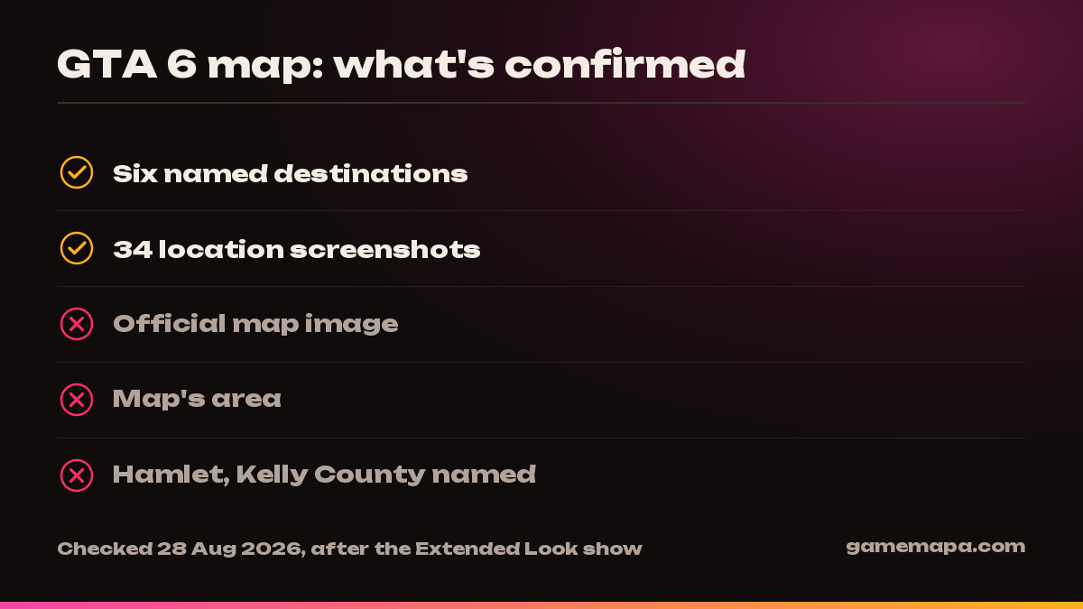
Updated 28 August 2026, after the An Extended Look show. The map still was not shown: it is absent from the Grand Theft Auto VI media library, and the Only in Leonida page lists the same six destinations as before the show. The library gained only the show itself — the screenshot and artwork counts did not change. More — our breakdown of the show. There is no official GTA 6 map. Rockstar has published neither a map image nor its area. What you find in search under “GTA 6 map” is fan reconstruction from two trailers’ worth of footage.
What does exist: six officially named destinations and 34 location screenshots. Below is only that, with links to the primary source.
The six destinations Rockstar itself named
The official Only in Leonida page carries a block headed “Visit Leonida — Tour a few of the must-see destinations across the sunshine state”. It holds exactly six buttons:
- Vice City
- Leonida Keys
- Grassrivers
- Port Gellhorn
- Ambrosia
- Mount Kalaga (the screenshot captions give the full name, Mount Kalaga National Park)
The state is called Leonida, and Rockstar’s own phrase for it is “the sunshine state”. Vice City is described as the “neon-soaked streets of Vice City and beyond”.
⚠️ One detail that usually gets lost: Rockstar’s wording is “a few of the must-see destinations”. That is not a claim to be a complete list of the game’s regions. Six is how many were shown, not how many exist.
How much of the map we have actually been shown
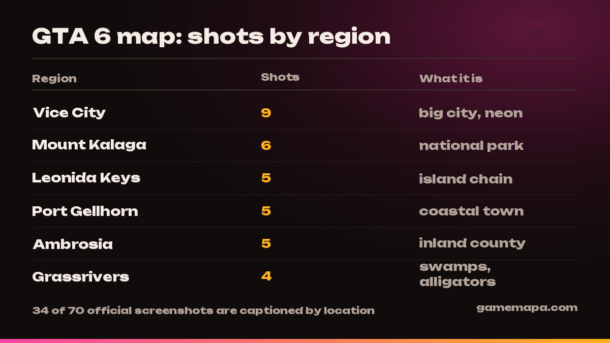
The GTA VI media library holds 70 official screenshots. We went through their captions: 36 are named after characters, and the remaining 34 are captioned with location names. Here is how they break down:
| Region | Official screenshots | What the place is |
|---|---|---|
| Vice City | 9 | big city, neon, beaches, airport |
| Mount Kalaga National Park | 6 | national park, hills, abandoned industrial site |
| Leonida Keys | 5 | island chain, bridges, turquoise water |
| Port Gellhorn | 5 | run-down coastal town |
| Ambrosia | 5 | inland county, small towns |
| Grassrivers | 4 | swamps, airboats, alligators |
| Locations total | 34 | + 36 character screenshots = 70 |
Vice City got nearly twice as many frames as any other region. That does not prove it is twice the size — but it does show where Rockstar is steering attention.
What the official shots show, region by region
We looked at one official screenshot from each region. This is a description of what is in the frame, not a retelling of rumours.
Vice City
A giant “VICE CITY” sign made of billboards on rusted supports, lit from below by floodlights, palm trees, a pink-and-orange sunset. A passenger jet passes low right above the sign with its landing gear down. Visually this is the same Miami look people loved in the original Vice City, at modern detail.
Leonida Keys
An aerial shot: a chain of green islets in turquoise water, linked by a long elevated road bridge. A seaplane in the foreground, boats below. The most valuable detail in the frame is that the Vice City skyline is visible on the horizon. So the Keys and the city sit in one connected stretch, not in opposite corners of the map.
That matches the official character bios: after the army, Jason Duval ended up “in the Keys” working for local drug runners, and the smuggler Brian Heder keeps a boat yard there.
Port Gellhorn
Night, a roadside motel with an old neon sign reading “Starlet Motel” — a bulb-lit arrow, the words “VACANCY”, “KING SIZE BEDS · LOW RATES”, “POOL & WIFI”. A shabby cabin, a pickup, palms, traffic cones. The mood is faded seventies America that never quite recovered.
Ambrosia
Morning on a small town’s main street: a column of bikers in vests patched “AMBROSIA” rides past a gas station and houses flying American flags. On the left, a road sign reads “Ambrosia County Sheriffs Office — TURN AHEAD”, with campaign placards on the lawn beside it. Hills on the horizon.
The key point: Ambrosia is labelled a county, not a city. So it is a whole rural region rather than a single settlement.
Grassrivers
A wooden dock in the swamps: three characters caked head to toe in mud, armed, an airboat beside them and an alligator on the boards. A sign on a post reads “NO TRESPASSING · VIOLATORS WILL BE PROSECUTED”. This is the recognisable Everglades: mud, palms, moonshine and no police at all.
Mount Kalaga National Park
The most surprising of the six. Dirt bikes tear through mud past abandoned concrete silos covered in graffiti and an overturned rail car. So the “national park” here is not only nature: inside it sits a derelict industrial zone that has clearly been repurposed for off-road racing.
What the official materials do not contain
This is where precision matters, because this is exactly the point at which most sites start inventing.
- A map image. The official media library has 3 videos, 9 clips, 70 screenshots, 22 pieces of artwork, 51 Ultimate Edition images and 12 for the Vintage Vice City Pack. No map.
- The map’s area. Stated nowhere. “X times bigger than GTA 5” comparisons have no official source.
- The names “Hamlet” and “Kelly County”. These circulate on fan sites as GTA 6 regions. We checked: they appear neither among the six official destinations nor in the caption of any of the 70 screenshots. That does not mean such places are absent from the game — it means only that Rockstar has not officially named them. Treat them as rumour.
- Whether the whole state is drivable from the start. Rockstar has said nothing about whether the map opens up immediately.
When to expect new footage
The nearest official event is Grand Theft Auto VI: An Extended Look on 27 August 2026. Rockstar has not promised to show the map specifically, but it is the first substantial material about the game since the second trailer.
The game itself launches on 19 November 2026 for PS5 and Xbox Series X|S.
In short
Officially we know six destinations in Leonida and have seen 34 frames of them. Everything else — maps with square kilometres, precise regional borders, lists of towns — is somebody’s reconstruction for now, however convincing it looks.
Frequently asked questions
Is there an official GTA 6 map?
No. As of 28 August 2026 Rockstar's official media library holds 3 videos, 9 clips, 70 screenshots and 22 pieces of artwork — no map image among them. Every 'GTA 6 map' circulating online is a fan reconstruction built from trailer footage.
How many regions are in GTA 6?
Rockstar has officially named six destinations: Vice City, Leonida Keys, Grassrivers, Port Gellhorn, Ambrosia and Mount Kalaga National Park. That is not necessarily the full list of regions in the game — it is the list shown on the site.
How big is the GTA 6 map?
Unknown. No official material — the game page, the Only in Leonida page or the media library — states the map's area. Any figure in square kilometres you see online is somebody's estimate from a trailer, not data from Rockstar.
Is there only one city in GTA 6?
Vice City is the only city among the six official destinations, but it is not alone. A road sign labels Ambrosia as a county, Port Gellhorn is a coastal town and Mount Kalaga is a national park.
When will Rockstar show the map?
The nearest official occasion is Grand Theft Auto VI: An Extended Look on 27 August 2026. Rockstar has not promised to show the map, but it is the first substantial material about the game since the trailers.
Sources
- Rockstar Games — Only in Leonida (the official list of destinations)
- Rockstar Games — GTA VI media library, 70 official screenshots
- Rockstar Games — official Grand Theft Auto VI page
- Rockstar Newswire — Grand Theft Auto VI: An Extended Look (6 August 2026)
- Rockstar Games — Grand Theft Auto VI: An Extended Look (official showcase page)
- Rockstar Games — Grand Theft Auto VI media library